On-site implementation of Z-ROVERBLOCK, an innovative system for accurately determining the z coordinate in the placement of block blankets
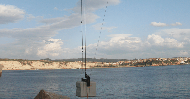
Rover Maritime has developed a new block positioning system for the execution of dyke protection mantels in the slope, capable of providing greater precision and control of the position of the blocks than other systems and methodologies used to date. This new system allows for accurate reproduction of the designed placement patterns, so that the mantle meets the porosity and stability parameters specified in the project.
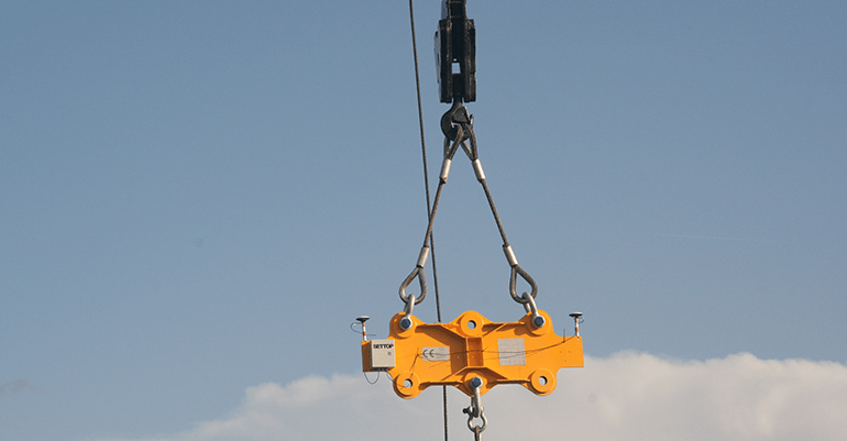
This X,Y,Z positioning system of blocks by crane is based on the placement of an auxiliary frame between the crane’s pen and clamp, on which a series of elements such as the GNSS antennas, their receivers and the telemetry system are placed. This eliminates the installation of the GNSS antenna and the encoder at the current tip of the pen along with their respective wiring from the crane pen to the crane cab.
The encoder was the device that until now allowed to determine the Z coordinate in an inexact way. With the new system, the Z coordinate is obtained without having to carry out constant encoder calibrations, which implies a considerable saving of placement time and costs, while also obtaining an accurate value. This is where the main novelty of the developed system lies.
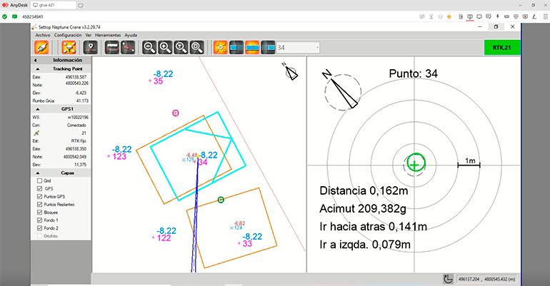
The GNSS positioning system integrated into the frame consists of two 1.5 m separate GNSS antennas with their respective GNSS receivers, connected to your radio-modem in order to obtain the differential corrections needed to work with centimetric accuracies. All this is powered by batteries with sufficient capacity for a full day of work and a telemetry system that sends the X coordinates,Y,Z of the center of the block as well as its orientation to the placement software used to monitor the placement process from the crane cab.
The main advantages of implementing the new placement system are:
- Complete information with XYZ coordinates of the final location of each cube placed on the mantle for perfect tracking of possible changes in position or displacements due to waves or temporary events that occur a posteriori.
- Removal of the GNSS antenna installation and encoder at the current pen tip and their respective cables that hinder breakage and coupling movements or cause signal loss when longer than 50 m.
- Can be mounted on any type of crane, opening a wide range of choice of cranes especially telescopic, since the need for old wiring from the tip of the rod towards limiting the maneuvers of these.
- The failures produced in the old systems made repairs very laborious and expensive: cable breaks, failures in the pasteca-encoder gear, GNSS antenna failures, etc.
- The change of crane is immediate, formerly involving a laborious disinstallation and a new installation.
The system has been put into operation for the placement of blocks in the work that is currently being carried out by the company at the Port of Bilbao and the first assessments have been very satisfactory.
The implementation of GNSS technology, telemetry and software has been developed by the company SettopSurvey S.L. and the manufacture and calculation of the frame to be able to lift blocks up to 120 tons was commissioned to the company Rúbrica Engineering.
The system has obtained the qualification of Technological Innovation according to RD 1432/2003 and UNE 166001:2006.